Visitor Map - USFS Lands 1.2.8
Free Version
Publisher Description


Visitor Map - USFS Lands - Find campsites, roads and trails in US National Forests/Grasslands.
Explore the great outdoors by visiting America’s backyard -- 193 million acres of national forests and grasslands. Find your perfect spot on these expansive lands that include more than 4,300 campgrounds and 158,000 miles of trails, including 31,900 miles on pristine wilderness areas.
Discover our rich cultural heritage at such destinations as Chimney Rock National Monument. Step back into time by stepping on tracks left 150 million years ago by dinosaurs at the Picket Wire Trail in southeast Colorado, where you also can see Native American rock art, ruins from the Dolores Mission and Cemetery and the old Rourke cattle ranch.
These lands also play host to more than 6,000 miles of wild and scenic rivers that offer leisurely rides passed awe-inspiring scenery or breathtaking rollercoaster-like rides down rapids. We are your year-round destination, including skiing on one of the 122 ski areas in the winter, photographing the bursting colors of wildflowers, cooking s’mores around the campfire in the summer or watching leaves change colors in the fall.
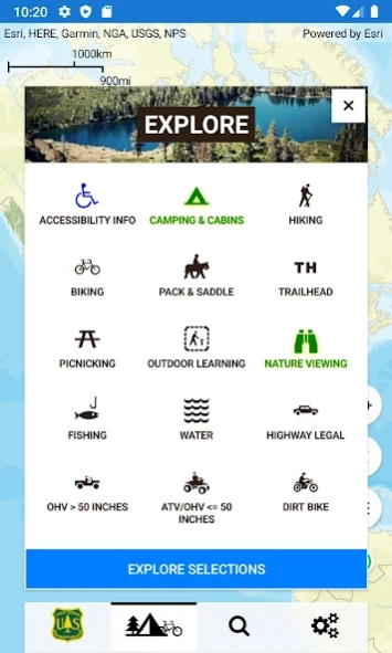
Notable app. features include:
* accessible recreation locations
* simplified and streamlined map interface
* national-level search capabilities
* wildfire and weather warnings/watches
* easily share the map through email or on social networks
* offline mapping
About Visitor Map - USFS Lands
Visitor Map - USFS Lands is a free app for Android published in the Recreation list of apps, part of Home & Hobby.
The company that develops Visitor Map - USFS Lands is USDA Forest Service. The latest version released by its developer is 1.2.8.
To install Visitor Map - USFS Lands on your Android device, just click the green Continue To App button above to start the installation process. The app is listed on our website since 2023-12-11 and was downloaded 1 times. We have already checked if the download link is safe, however for your own protection we recommend that you scan the downloaded app with your antivirus. Your antivirus may detect the Visitor Map - USFS Lands as malware as malware if the download link to gov.usda.fs.gtac.ivm is broken.
How to install Visitor Map - USFS Lands on your Android device:
- Click on the Continue To App button on our website. This will redirect you to Google Play.
- Once the Visitor Map - USFS Lands is shown in the Google Play listing of your Android device, you can start its download and installation. Tap on the Install button located below the search bar and to the right of the app icon.
- A pop-up window with the permissions required by Visitor Map - USFS Lands will be shown. Click on Accept to continue the process.
- Visitor Map - USFS Lands will be downloaded onto your device, displaying a progress. Once the download completes, the installation will start and you'll get a notification after the installation is finished.
